|
|
|
Adams Farm Recon for Barn Burner Series The evening's mission: course recon for this weekend's Barn Burner races at Adams Farm in Walpole.
Here's my resulting Strava track. Sometimes, you can look at Strava and pretty much figure out how the ride went (the "picture's worth a thousand words" conjecture). This is NOT one of those times. My Strava Track 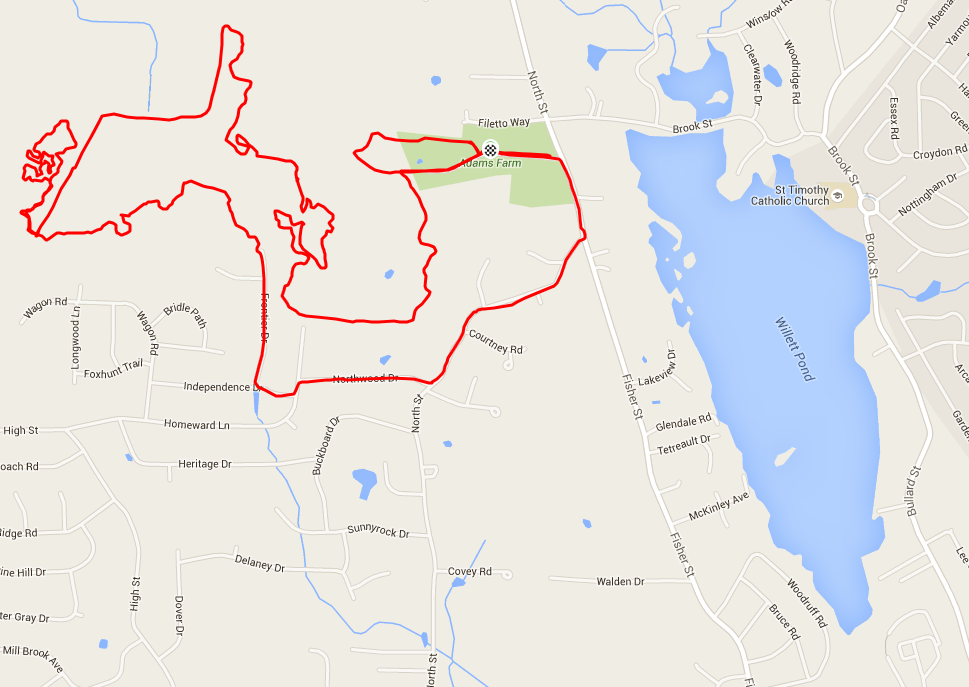
I rolled from the parking lot on my MTB a bit before 7p, quickly (and uneventfully) circumnavigating the short counterclockwise CX loop (upper middle). Summary: boring. Easy turns, almost no elevation change, nothing off camber, good traction everywhere, and only one tricky rock garden section (potentially rideable, but dismounting/remounting looked to be the safer move). Conclusion: Saturday CX not worth the time and effort for a 30 minute race. Next up: check out the longer MTB loop. Despite having the GPX file in my Garmin, I couldn't find the start. I did find the finish, however, so my plan was to ride the loop in the reverse direction, then redo it in the proper direction. (In hindsight, I found this reverse-then-forward plan to be a great way to get a feel for the course, but the reverse direction may not always be an option depending on when you're riding.) I learned fairly quickly that the course exceeded both my technical ability and my tolerance for annoyance. There were enough rock gardens that I couldn't clear to convince me. And the generally rooty and rocky track simply wasn't any fun. Conclusion: Sunday MTB not worth the time and effort for a race that best case wouldn't involve an emergency room. So, that's it for the ride report, right? Uh, not quite. I continued around the loop (still in the reverse direction, as evidenced by the course arrows facing the other direction) ... until finding myself seeing the arrows as if I were going in the proper direction. Clearly, I'd missed something, but what? Here's the official course made available from the race organizer. The Official Course 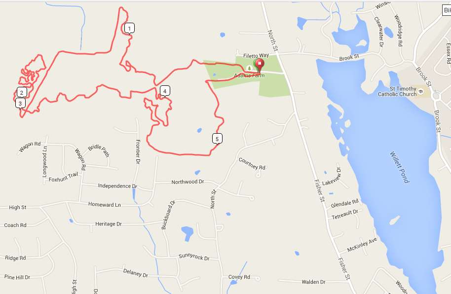
Note where the course comes together adjacent to the upper left of the 4 mile mark (Official Course). In the reverse direction, I should have turned left to head West, but instead, I continued straight across (North), putting me relatively early on the outbound portion of the loop (in the correct direction). I continued along the wooded singletrack until just after the 1 mile mark (Official Course), then popped out into a meadow. A bit farther along, I headed back into the woods for a short bit, then hit the powerline trail (marked by the longish straight line toward the upper left). I passed a trail runner on the uphill, then found myself face to face with a pretty brash deer. We stared at each other for a while, I fished my phone out of my pocket, snapped a pic, and that task complete, the deer bounded off. 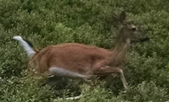 Then, back into the woods for the convoluted singletrack at upper left. Keep in mind the distance from the start as I relate my first ever breaking of a chain while riding. Keep in mind that distance as I relate my searching my saddle bag for my quick link. And keep in mind that distance as I relate my remembering my quick link stowed safely in a Camelbak pocket back at home. (I had a chain tool. I could perhaps have shortened the damaged chain and used one of its own pins as a replacement, but a motivated squadron of mosquitoes pounced whenever my pace dropped below a brisk walk.) Ride over. Hike initiated. What the maps above don't really convey is the terrain between where I was (3 mile mark on the Official Course) and the parking lot all the way East. In short, woods. Thick woods. And by now, it was after 8p. Yep, I was lost. Fortunately, I had both my Garmin and my phone to help me navigate. If you refer back to my Strava track (the upper map), you'll see that I pretty successfully made my way East from just north of Wagon Road. Then, the track inexplicably bangs a right to head straight South. Why? Well, my Gamin showed roads, and my ears registered kids playing. I figured I could take the longish way back by road or wander the woods for who knows how long. Prudence (and hunger) won, and I hit the roads (not noting until I was back how close I was to finding the direct trail back to the start). The route back was two parts hike-a-bike, one part coast downhill, and before too long, I was at my car and packing up with a decent story to tell (and one that the Strava track doesn't begin to convey. A thousand words? Hardly.). |